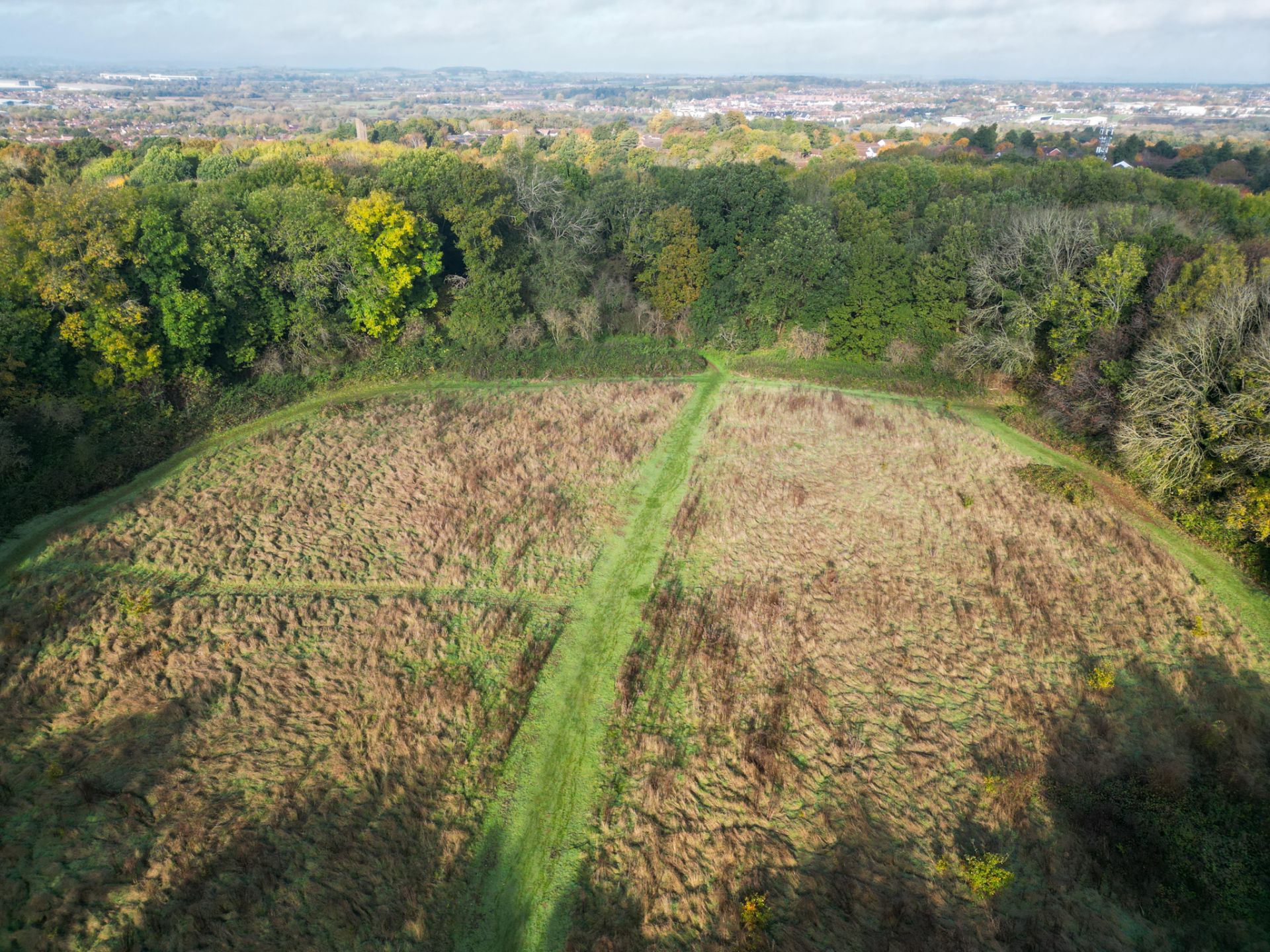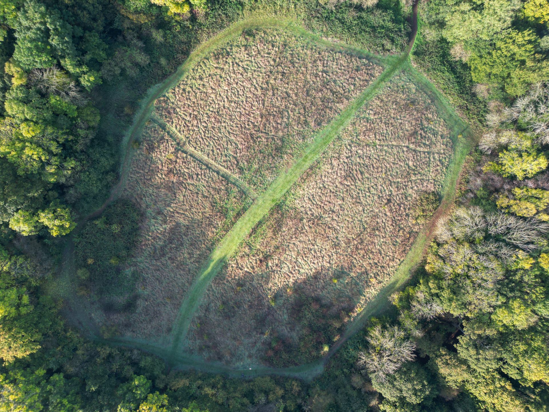
In recent years, I have spoken extensively about the Iron Age hillforts of Northamptonshire (Borough Hill pictured to the left). Like many other counties, Northamptonshire has its share of these ancient monuments, which have attracted varying degrees of interest over time. Despite ongoing discussions and research, our understanding of these structures and their significance in the modern landscape continues to evolve, sparking fascinating conversations in course sessions.
Northamptonshire’s hillforts
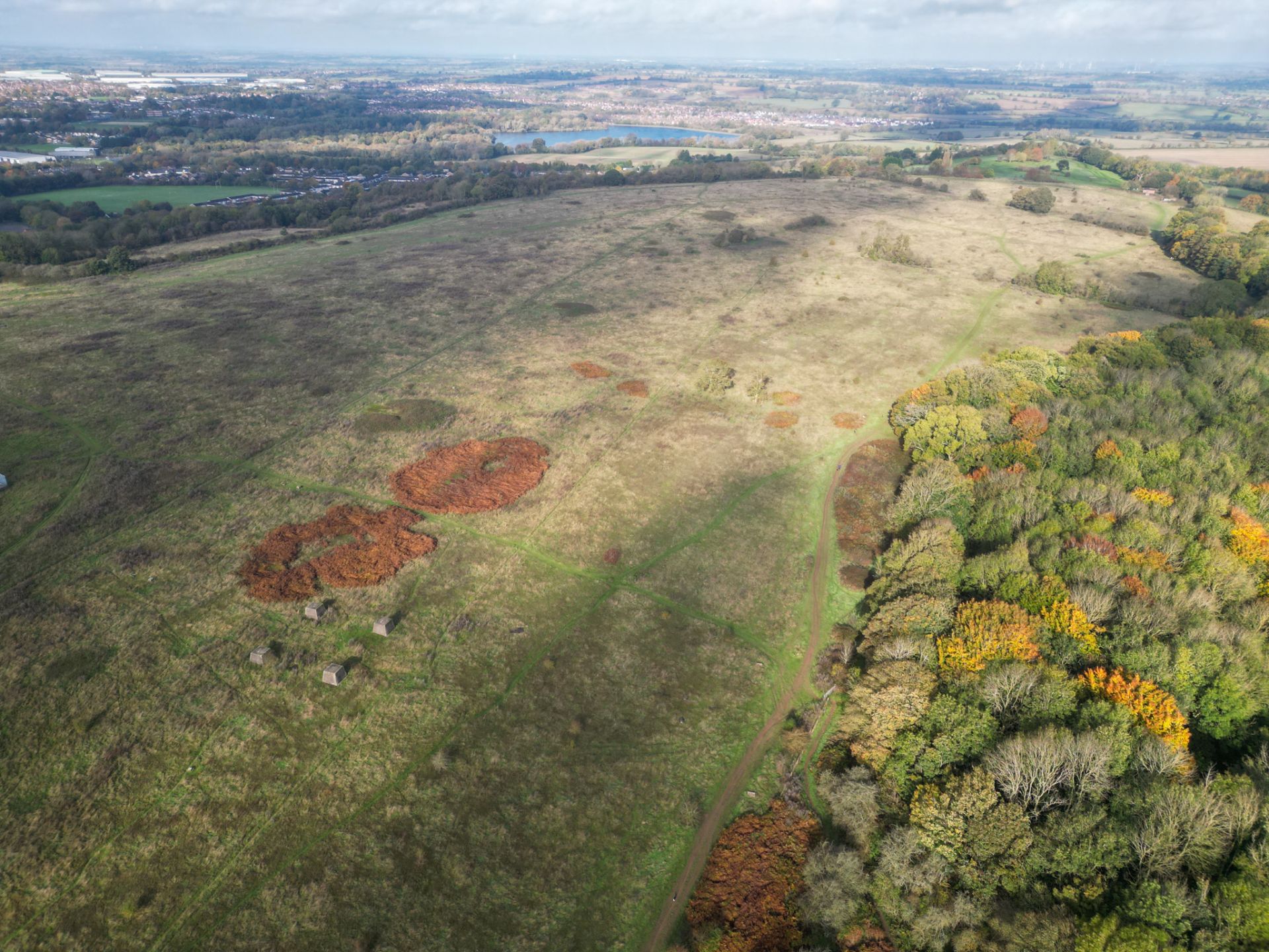
began appearing in the late Bronze Age and remained functional until the Middle
Iron Age. They vary in size, shape, and complexity, though many share common
characteristics—particularly the damage inflicted upon their enclosed areas by
later agricultural use and quarrying. This is a familiar challenge in
archaeological sites across the county. Additionally, artifacts recovered in
past excavations have, in some cases, been lost to modern research, further
complicating our understanding of these sites.
Nevertheless, these hillforts
endure as striking features in the landscape, offering insight into a time when
Northamptonshire’s terrain was vastly different from today. As a Landscape
Archaeologist, I have been revisiting these sites, equipped with a camera and
drone, to document them in their current state. When these forts were first
constructed, the surrounding landscape was undergoing significant change, with
woodland being cleared for agriculture—a transformation still visible today in
crop marks and aerial photographs of ancient field systems and farmsteads.
New threats to these sites continue to emerge. For example, Hunsbury Hillfort, now almost enveloped by the urban spread of Northampton, faces challenges despite being a scheduled monument. Heavy foot traffic, walkers, and even pit bike riders place additional strain on its earthworks. This growing concern has fuelled my determination to document and preserve the visual record of these hillforts as they exist today.